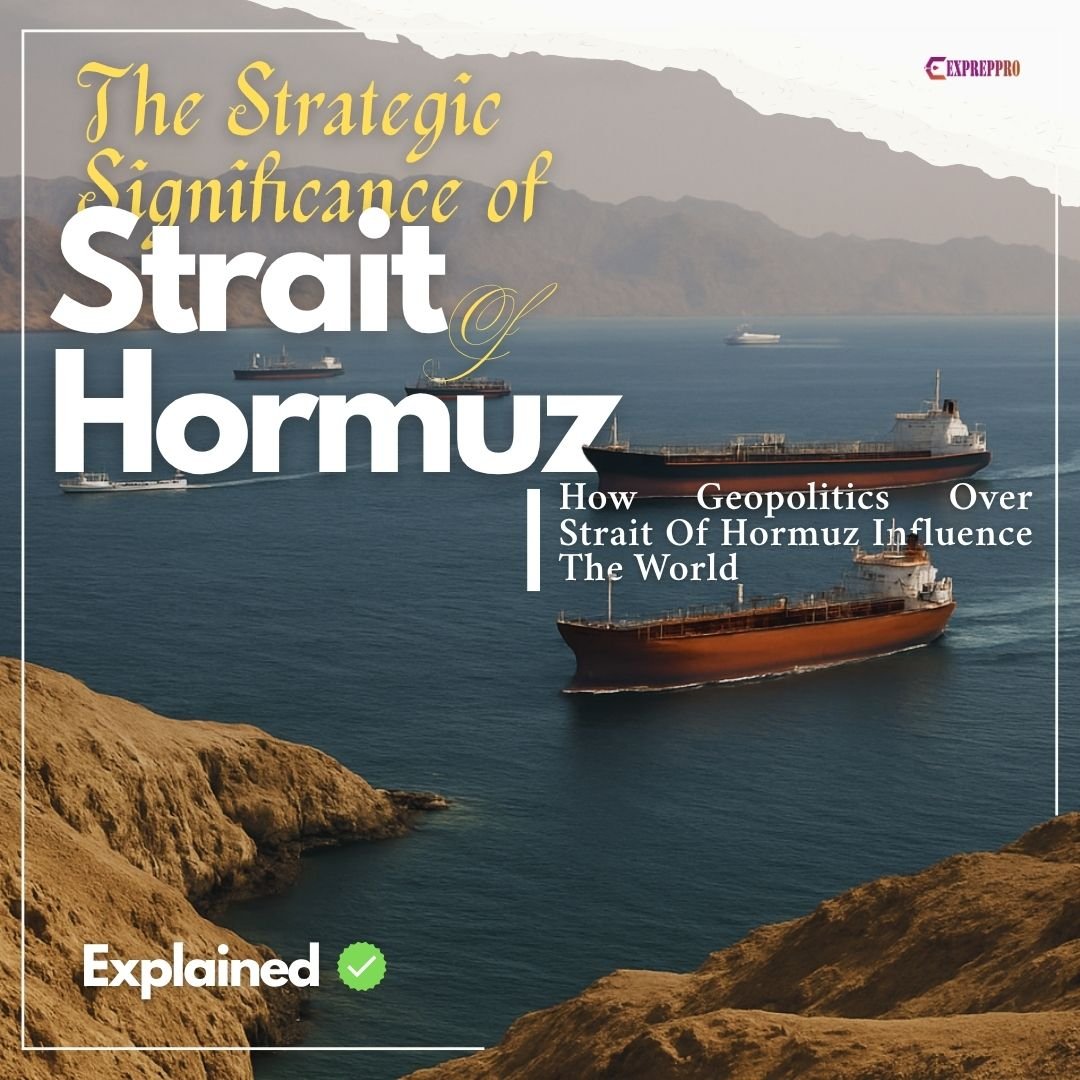
The Strait of Hormuz is a strategic maritime choke point linking the Persian Gulf with the Gulf of Oman and Arabian Sea. Hormuz Strait connects the Persian Gulf to the Gulf of Oman and the Arabian Sea. In the event of a blockade of Hormuz, the world economy will feel its tremors.
Geography OF Strait Of Hormuz
The Strait of Hormuz is a small pass to the Persian Gulf that separates Iran and the Arabian Peninsula. Hormuz Strait connects the Persian Gulf to the Gulf of Oman and the Arabian Sea.
The North coast of the strait is Iran, and on the South coast is Musandam, an Omanian enclave. It is not part of the U.A.E, and Musandam shares borders with the Emirate of Ras al Khaimah and the Emirate of Sharjah of the U.A.E.
The total area of the Persian Gulf is 240,000 square kilometres, and its width varies from 65 kilometres to 338 kilometres.
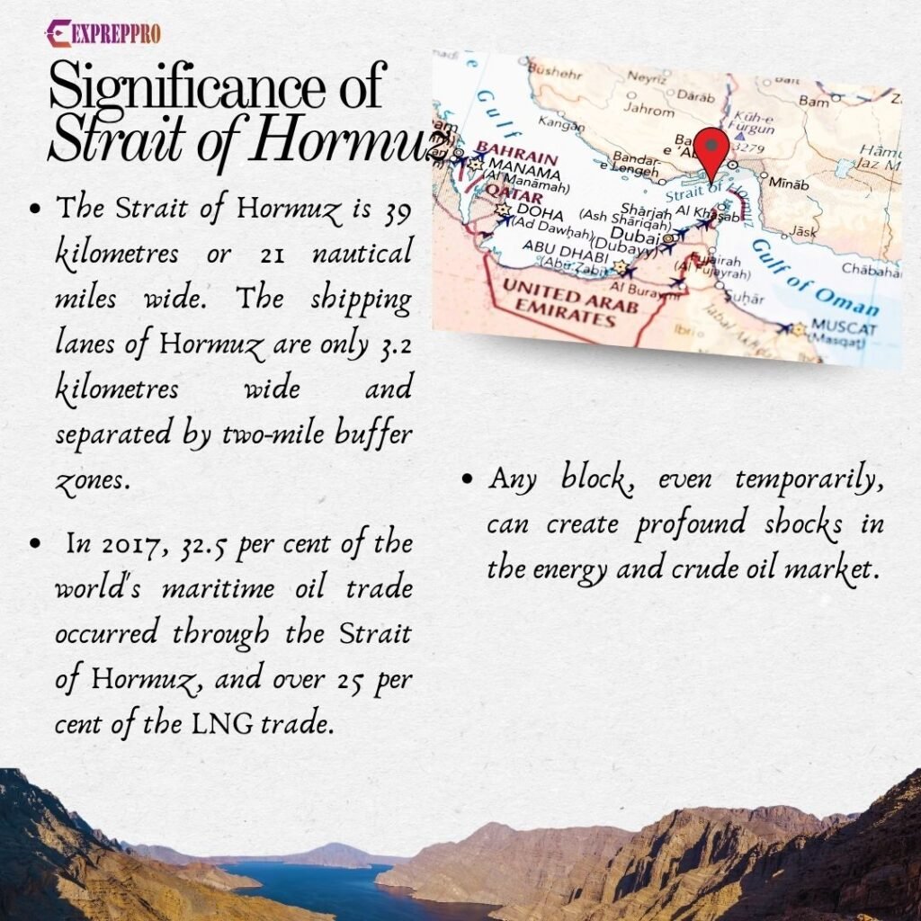
The maximum depth of the Strait of Hormuz is 60 to 100 meters at the entrance. The strait is 39 kilometres or 21 nautical miles wide. The main shipping channel lanes utilise the shortest route. The shipping lanes of Hormuz are only 3.2 kilometres wide and separated by two-mile buffer zones. It is deep enough to handle the largest crude oil tankers of 150,000 dead weight.
The Hormuz Strait is critical to the world because at least 35 per cent of petroleum trade by sea is carried to destinations through this route. It is projected that the number may rise to 60 per cent by 2060.
Geopolitical Importance of Hormuz
Due to its geo-political importance, Cyrus Vance, former US Secretary of State, once mentioned it as: “the jugular vein of the West”.
The total petroleum products trade through Hormuz was 18.4 million barrels per day in 2015 and 20.7 million barrels per day in 2018. In 2017, 32.5 per cent of the world’s maritime oil trade occurred through the Strait of Hormuz, and over 25 per cent of the LNG trade.
Due to its importance, the Strait of Hormuz is considered one of the three chock points in the Middle East, and a block in these points can create trouble. The other two choke points are the Strait of Bab el Mandab (connecting the Red Sea and the Gulf of Aden) and the Suez Canal (connecting the Red Sea and the Mediterranean).
Iran’s Advantage In Strait Of Hormuz
Most deep-sea areas of the Persian Gulf are within Iranian territorial waters, and this gives Iran an advantage. In 1934, Iran claimed territorial waters in the Gulf of Persia, the Hormuz Strait, and the Gulf of Oman, extending six miles from the low-water marks of its coastline, and later claimed the right to explore oil on its continental shelf. After this move, Arab countries in the peninsula also followed Iran’s path and made similar claims.
The 3.2-kilometre passage can handle traffic, but it is a congested waterway. So, any block, even temporarily, can create profound shocks in the energy and crude oil market. Iran and other countries in the region are well aware of this fact.
Iran possesses several islands at strategic locations, including Larak, Hormuz, Qeshm, Hengam, Greater Tunb, and Abu Musa, which enable the Iranian Navy to conduct effective surveillance. (These islands lie near the trade route)
Oman is the only nation that holds control over the Qu’oin Islands in the middle of the Strait. This creates a situation that favours Iran. The Abu Musa Island was initially under the control of the Emirate of Sharjah, U.A.E. Later, Abu Musa was controlled by Britain. In 1971, Iran occupied the island of Abu Musa. Thus, the U.A.E lost control over not only the island but was also a strategic point for trade route surveillance.
The Shah of Iran signed an agreement in December 1977 with Oman to share the responsibility of security. This agreement gave Iran authority to patrol the key route in Omani waters. They even relocated the naval headquarters to Bandar Abbas, near the northern end of the Strait of Hormuz, and developed a new port at Chah Bahar, near the Gulf of Oman.
With the Islamic revolution, everything changed, but still, Iran holds supremacy through their islands.
In 1993, Iran passed a law that extended its territorial waters to include the waters around the islands under its control. According to Article 2 of the Marine Area of the Islamic Republic of Iran Act, “The breadth of the territorial sea is 12 nautical miles, measured from the baseline. The islands belonging to Iran, whether situated within or outside its territorial sea, have, in accordance with this Act, their own territorial sea”. The USA rejected the declaration.
The UK and Oman ships aborted the Iranian attempt to challenge others’ authority not only in late 1980 but also in mid-1983.
Iran also created a 100-kilometre Goreh Jask oil pipeline to bypass the Hormuz Strait. This pipeline carries oil to Jask port in the Gulf of Oman. In the event of a blockade, they can continue their exports, while others across the strait may suffer. ( The Strait of Hormuz historically remains open for traffic without any challenges, but Iran made threats to block it in case of an attack. They made similar threats in the 1980s during the Iraq war, 2008, 2011, 2012, 2019 and 2022)
History Of Hormuz Strait
Early mentions of the importance of the Hormuz Strait are found in the records of the Ming rulers of China. In the early 1400s, Admiral Zheng, with his treasure fleet, visited Hormuz.
The original city of Hormuz was a port on the mainland near Minab Oasis, east of Moberd Bandar Abbas (Port). But now, Hormuz is an island located strategically on the trade route.
The first prominent person to place Hormuz’s importance was Mahmud al Qalhat, a trader. Through his wife, the daughter of the ruler of Hormuz, he reached the throne and established independence with a Navy with manpower from nearby coasts like Oman.
In the early 1500s, the Portuguese captured the city and made its ruler a vassal. Hormuz port had trade relations with different parts of the world like Aden, Jiddah, Siam, Sumatra, Zanzibar, Abyssinia, China, Malbar, Vijanagara, Gujrat and Cambay. The horse trade and Pearl trade were important in this port.
Britain captured the Island of Hormuz in 1662 from Portugal. Portuguese was the first modern European power in history to occupy a post in the Gulf region. They made a factory in Muscut in 11458 and controlled trade in the Persian Gulf for almost 150 years. The Portuguese were finally thrown out by Arabs in 1650.
In 1766, Britain brought an end to the Dutch presence. During the Napoleonic Egypt adventure, Britain created treaties with Oman Sulatna and the Shah of Iran. This helped to hold their position safe. East India Company effectively established deposits in the Gulf and took charge of the Gulf till 1858. Then it passed to the British Government in Bombay until 1873 and later the British government.
Everyone signed a treaty with the British power except Qatar. Bahrain signed this treaty in 1880 and in 1892. Sheikhs of Emirates signed in 1892, and Kuwait signed in 1899. Qatar was then under the nominal suzerainty of the Ottoman Empire; they signed the treaty in 1916 after the Ottoman defeat. After Indian independence, it was passed to the Foreign Office in London.
When the Shah of Iran created a Modern Navy, they took effective measures to bring the strategic Strait of Hormuz under them. After the Shah, the Islamic Republic of Iran got that position. Iran didn’t recognise the Strait of Hormuz as international waters. Iran signed the Geneva Convention on the Territorial Sea in 1958 and the Contiguous Zone and the UN Convention on the Law of the Sea in 1982 but never ratified them. They created its own national maritime law in 1993 without acknowledging the Strait of Hormuz as an international strait.
Why Hormuz is Important For Iran?
- All essential imports that are not covered under embargo happen s through the ports located in the Strait of Hormuz. Two-thirds 10 of the government’s budget comes from the revenue of exports which pass the Strait of Hormuz. In case of a block, Iran’s economy may suffer.
- Around two million barrels of Iranian oil pass through the Strait of Hormuz every single day. The export of crude oil is responsible for about 15 per cent of Iran’s Gross Domestic Product, and it is necessary for Iran’s economy.
- To secure their position, Iran created two naval forces. The Islamic Revolutionary Guard Corps Navy (IRGCN) or (Persian Acronym)NEDSA and the Iranian Navy. IRGCN guards the Persian Gulf Coast, and the Iranian Navy patrols and guards the Gulf of Oman and the area beyond. This asymmetrical technique is to guard their trade and geo-political interests.
What happens if Iran closes the Strait of Hormuz?
- A closure of the Strait Of Hormuz can further escalate the situation and seriously affect the world economy. Around 82% of crude and other fuel shipments that traversed the strait went to Asian consumers. China, India, Japan and South Korea were the top destinations, with these four countries together accounting for nearly 70% of trade through Hormuz. So these are the countries that may feel the tremors but will not be affected fully due to alternate options created by the U.A.E and Saudi Arabia.
- A closure may increase oil prices by 25 per cent or around 15 dollars per barrel on average and may range between 8.25 to 31.25 dollars. If the situation gets worse or lasts for longer, then the price may increase further further beyond the 100 dollar per barrel mark. In the extreme case, long-term oil prices may increase by at least 50 per cent and 130 per cent at maximum. (These are projections and may vary)
- Qatar is the third-largest exporter of LNG, making up around 20 per cent of global trade, and all the supply moves through the Strait of Hormuz. In this case, Qatar, which is the largest exporter of LNG to India, and a block may affect Indian LNG consumption. Along with India, other Asian countries also suffer.
- An increase in Oil prices may affect the GDP of importers and Exporters. A 10% increase in oil prices leads to a 0.1 – 0.2 decline in GDP growth.
- CPI of Iran will show the worst fall in case of the closure of the Strait of Hormuz. Ultimately, this will hamper the lives of common men in Iran.
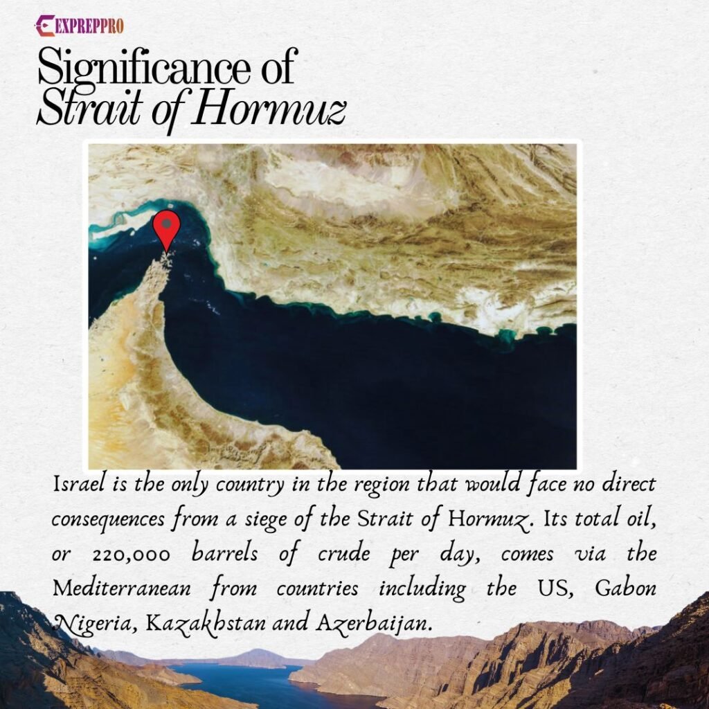
- Israel is the only country in the region that would face no direct consequences from a siege of the Strait of Hormuz. Its total oil, or 220,000 barrels of crude per day, comes via the Mediterranean from countries including Azerbaijan (exported via the Baku–Tbilisi–Ceyhan pipeline, which runs through Turkiye to the eastern Mediterranean), the US, Brazil, Gabon and Nigeria.
Alternate Route to Deliver Oil in Case of Blacked of Strait of Hormuz
- Saudi Arabia’s Petroline (East-West Pipeline) and the U.A.E.’s Abu-Dhabi crude oil pipeline are the solutions.
- The Abu Dhabi pipeline connects the Bab-Habshan oil and gas field in Abu Dhabi with Fujairah on the Gulf of Oman, which enables the U.A.E. to bypass the Strait of Hormuz. Fujairah port is in the Gulf of Oman, so the block will not affect the port. 1.8 million-b/d pipeline links onshore oil fields to the Fujairah export terminal in the Gulf of Oman.
- Saudis major production occurs in the North East region, and the nearest port is in the Persian Gulf. But Saudi Aramco operates the 5 million-b/d East-West crude oil pipeline, which runs from the Abqaiq oil processing centre near the Persian Gulf to the Yanbu port on the Red Sea.
- Export may decrease, but a full block is impossible due to these pipelines. However, countries like Qatar and Kuwait may be affected partially.
- The US 5th Fleet, along with other allies in the Middle East, is responsible for guarding the trade route via Hormuz, so a long-term block is not possible.